Thakhek District (Muang Thakhèk)
Thakhek (Lao language: ທ່າແຂກ), the capital of Khammouane Province, is a town in south-central Laos on the Mekong River. The Third Thai–Lao Friendship Bridge, linking Thakhek and Nakhon Phanom, Thailand, across the river, started in 2009 and was opened on 11 November 2011.
The city has many French colonial style official buildings, villas, and shops. In 1943, 85% of the population of Thakhek were Vietnamese due to the French policy of encouraging Vietnamese immigrants to Laos. Remnants of the abortive Thakhek-Tan Ap railway can be seen in and near the town. The railway would have run between Thakhek and Tân Ấp Railway Station, Quảng Bình Province, Vietnam through the Mụ Giạ Pass.
Western scientists first encountered the Laotian rock rat, kha nyou (Laonastes aenigmamus), in Thakhek's market.
Map - Thakhek District (Muang Thakhèk)
Map
Country - Laos
 |
 |
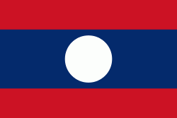
| Flag of Laos | |
Present-day Laos traces its historic and cultural identity to Lan Xang, which existed from the 13th century to the 18th century as one of the largest kingdoms in Southeast Asia. Because of its central geographical location in Southeast Asia, the kingdom became a hub for overland trade and became wealthy economically and culturally. After a period of internal conflict, Lan Xang broke into three separate kingdoms: Luang Phrabang, Vientiane and Champasak. In 1893, the three territories came under a French protectorate and were united to form what is now known as Laos. It briefly gained independence in 1945 after Japanese occupation but was re-colonised by France until it won autonomy in 1949. Laos became independent in 1953, with a constitutional monarchy under Sisavang Vong. A post-independence civil war began, which saw the communist resistance, supported by the Soviet Union, fight against the monarchy that later came under influence of military regimes supported by the United States. After the Vietnam War ended in 1975, the communist Pathet Lao came to power, ending the civil war. Laos was then dependent on military and economic aid from the Soviet Union until its dissolution in 1991.
Currency / Language
| ISO | Currency | Symbol | Significant figures |
|---|---|---|---|
| LAK | Lao kip | â‚ | 2 |
| ISO | Language |
|---|---|
| EN | English language |
| FR | French language |
| LO | Lao language |


